Introducing Jeremy Crampton
 Jeremy Crampton is Associate Professor of Geography at the University of Kentucky.
He received his PhD from Penn State University in 1994, and has since held positions in the UK and US (previous one was at Georgia State University). The research interests of dr Crampton include political representation of space, especially through mapping and GIS. More specifically, he studies the historical genealogy of spatial and geographic knowledges, and contemporary developments in the spatial geoweb.
For more information about his work, please check the Blog by Jeremy Crampton.
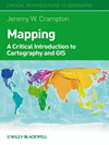
This is part 2 of an interview in which dr Crampton elaborates on his book “Mapping: A Critical Introduction to Cartography and GIS”. Part 1 is Jeremy Crampton: Geographic Information Systems, landscape, mapping technology
Interview
Effects on and of mapping, and the past and future of cartography
What has been the influence of graphic design on cartography?
 I think it’s had a quite strong, but very particular influence. Cartography (the discipline) has been historically receptive to certain approaches to design that provide a rationality of design, of rules of design.
So for example in the post-war era we see influences coming out of the psychology of design, especially perception and cognition. This is conceived of as “users” who perceive and cognize the look of maps.
If this can be nailed down then we can feed the results of this back into map design. In fact, I think this has produced hardly any lasting change to map design, although it has told us a lot about human perception and cognition, not just of maps, but of space and geography.
The primary worker here has been Reg Golledge who for many years was at Santa Barbara, but this work continues in applications to visualization by my colleague Sara Fabrikant. Some of my earlier work was in this area, for example in the cognitive account of wayfinding through the environment.
Another whole area has come from graphics, such as the work of Jacques Bertin and Edward Tufte. Both of these offered easy to teach formal or rule-based approaches to design.
But I think that historically you see much more experimentation going on in cartography. There were more forms of maps that were played with, more cartodiversity if you like. These have been eclipsed because they’re hard to implement formally in GIS, so many of them died out. Now we have a more constrained set of maps to work with, the choropleth, the dot distribution map, the proportional symbol map and so on.
How do power/knowledge relations affect mapping?
This is a good question. Of course, not everybody agrees that power/knowledge relations should play a role in mapping, but this opinion is largely confined to cartographers. But not all.
Interestingly, some of the first people to investigate relations of power were historical geographers and historians of cartography. We have very rich accounts of colonial mappings, for example of Napoleon in Egypt (Anne Godlewska) or the Columbian Encounter, which was the subject of an exhibition organized by Brian Harley just before he died in 1991. There are some great essays on this in The Imperial Map edited by Jim Akerman (2009).
It’s been harder, I think for people to understand how contemporary mappings exercise power/knowledge. My own approach has been to understand mapping as a technology of government and the state. Most recently I’ve traced the relationship of mapping to geographical intelligence, for example in America’s first spy agency, the OSS in World War II.
But I think this could be equally productive for contemporary developments in the spatial geoweb. What’s still missing is a sense of this relation historically, a historical genealogy if you like. This doesn’t necessarily have to follow Foucault, however.
Why does mapping play a role in the construction of identities?
There’s a famous saying coined by the geographer Bernard Nietschmann: “map or be mapped” which perhaps sums it up. Of course Nietschmann worked with indigenous groups on this.
A map is an assertion of identity, “this is there” in Wood’s phrase. When you say “this is there” you make an identity claim, because the “this” in that statement uses categories that however naturalized are ultimately socially constructed (and real). An identity claim is to assert or reaffirm a meaningful category.
I think maps can be understood as part of a process of identity formation, and not just mirrors held up to pre-existing identities. This includes national identity, race, sexual identities, spaces of fear and threat, and so on.
There’s a famous racist book by Madison Grant, written in the 1920s, who was a lawyer and Council member of the American Geographic Society, called “The Passing of the Great Race.” You can guess which race he had in mind!
He used maps which he published in the AGS journal “The Geographical Review” to bolster his claimed pattern of racial distributions.
What is the economy of morality and how does this concept relate to mapping?
My argument at that part of the book [i.e. the introduction] was to try and problematize two things. On the one hand, that maps, mapping and the spatial geoweb are essentially either liberatory (we see this for example in discussions concerning overcoming the digital divide by implementing technological solutions), or essentially exploitative (eg., they are part of the colonial project, or as Arno Peters argued the Mercator projection is racist).
On the other hand, there’s the argument that maps are essentially neutral and can be deployed at will. I wanted to resist both approaches.
One way to do this, I suggest, is by situating mapping and GIS more contextually as technologies of government. By “government” I do not mean the government of the day, nor even less the political parties such as the Republicans or Labour party.
Governmentality is a concept developed most usefully I think by Foucault, which to put it briefly refers to the set of rationalities (discourses) and associated tools and concepts for governing. In the case of maps you could write a whole history of the way that they are developed for government (including the military and intelligence sectors, eg., geospatial intelligence or GEOINT). This might be for knowing and assessing the territory of the state in its physicality and exploitable resources, or it might be for assessing and knowing the geographical qualities of the population.
An example here is the first statistical atlas of the United States, based on the 1870 census. The Superintendent of the census was a man named Francis A. Walker. Walker was very concerned with immigration, and the different groups who as he saw it might strengthen or weaken the nation.
Matthew Hannah wrote a masterful book on this in 2000 (“Governmentality and the Mastery of Territory in Nineteenth-Century America”).
In addition, there’s the concept of the moral economy and also in the nineteenth century the concept of moral statistics.
The latter relate to mapping as this was a means for the early political economists to ascertain the state of play within the nation in terms of things which might sap its strength—moral abnormalities if you like.
What were the divorce rates around the country? How many children were couples having? Were people marrying too early? Where was delinquency and crime?
Today you see some of the same questions in crime mapping and the use of rational policing through statistics, but perhaps with a different moral overlay.
(Or not; in the recent London riots, some of the discourse emphasized the rioters’ “feral” nature, that is, their non-human, almost animalistically wild behaviour.)
How has cartography recently changed and what could the future hold in this respect?
That’s a big question. In the book I suggest what I call a one-two punch.
On the one hand you’ve got more interesting theorizations of mapping, the politics of mapping as it were. On the other, you’ve got these new, potentially more democratic tools and capabilities in the spatial geoweb or new spatial media.
Of course there’s resistance to these developments, a tension across the field of cartography and mapping. When you open up the production of knowledges, those with vested interests will seek to formalize knowledge production behind certifications and regulations. Sometimes that can be useful, but as much as it might qualify people, it will also exclude others.
There’s also others who will ask whether these capabilities are really democratizing or only potentially so. As with anything, there’s nothing inherently liberating about technology.
